
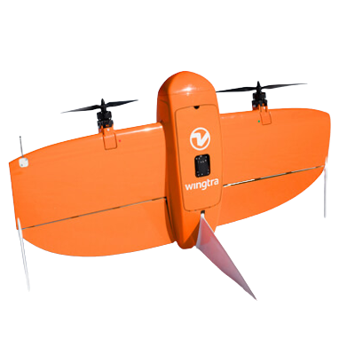
Wingtra ONE VTOL![]()
Wingtra One is a VTOL fixed-wing survey drone built for large-area photogrammetry. It takes off and lands vertically but flies like an airplane, allowing it to cover huge areas in a single flight. It’s great because it delivers exceptional accuracy without ground control points, dramatically reducing field time while producing clean, consistent data for large mapping and environmental projects.
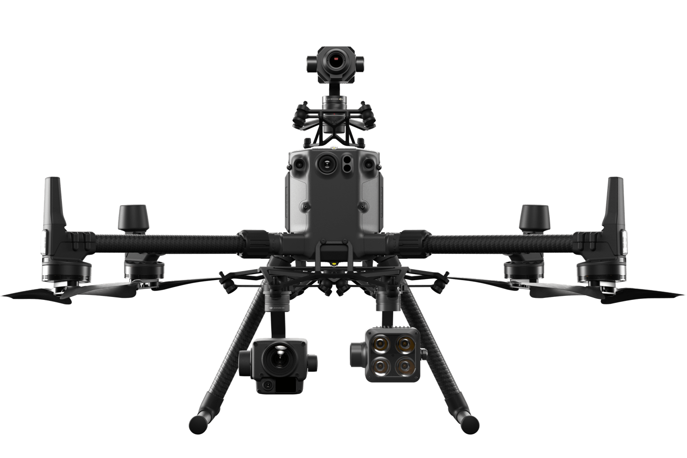
DJI M300![]()
The DJI M300 RTK is a professional heavy-lift multirotor drone designed for precision surveying and inspection. It carries advanced payloads like LiDAR and mapping cameras while delivering centimeter-level positioning through RTK. It’s great because it’s incredibly reliable, weather-resistant, and versatile, making it ideal for high-accuracy mapping, inspections, and complex survey missions where stability and repeatability really matter.
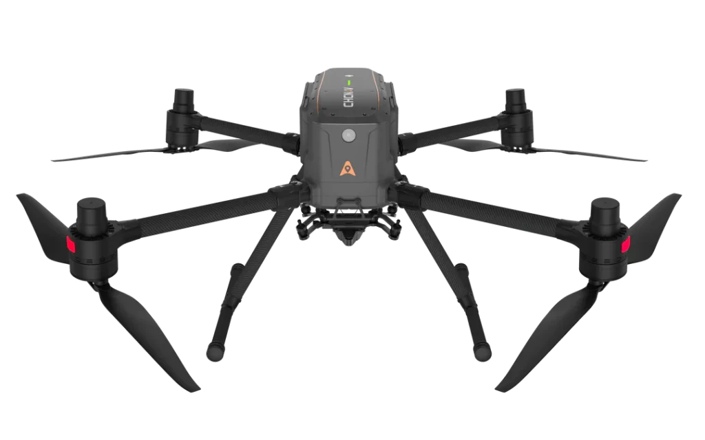
CHCNAV X500![]()
The CHCNAV X500 is a heavy-duty industrial drone designed for long endurance and high-payload survey missions. It can carry LiDAR systems and large cameras for extended flights even in tough conditions. It’s great because of its redundancy, long flight times, and hot-swap batteries, making it perfect for demanding LiDAR, corridor mapping, and critical infrastructure surveys.
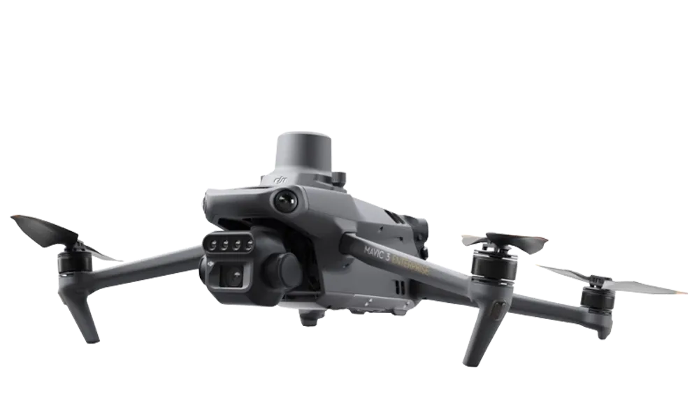
DJI Mavic 3M![]()
The DJI Mavic 3M is a survey-ready version of DJI’s compact flagship drone with built-in RTK and a multispectral camera suite designed for precision mapping and analysis. It delivers ultra-sharp imagery with mechanical shutter and centimeter-level positioning (1 cm + 1 ppm) for accurate orthomosaics and GIS datasets. It’s great because it combines powerful mapping capability with lightweight portability so you can get detailed aerial data without the huge rig
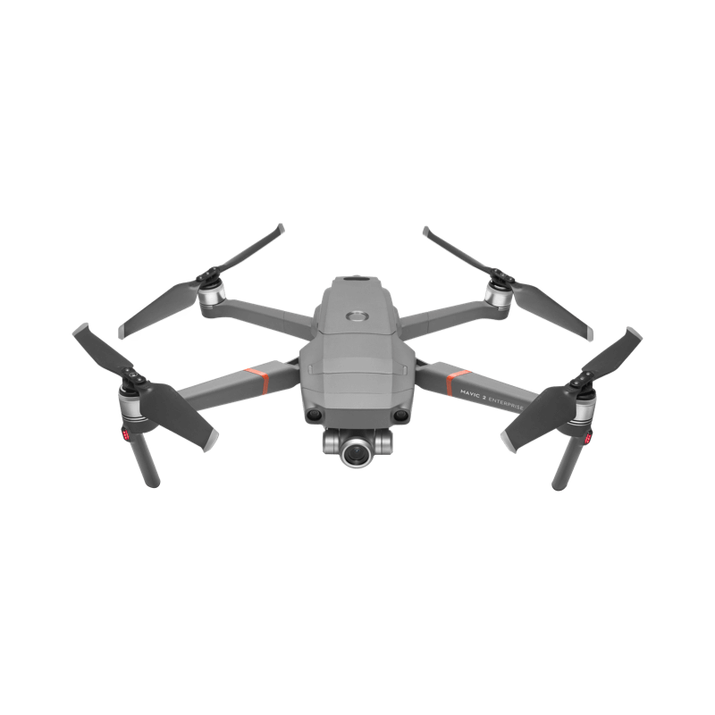
DJI Mavic 2 Enterprise![]()
The DJI Mavic 2 Enterprise is a versatile compact professional drone built on DJI’s reliable Mavic 2 platform with modular accessories like spotlights and speakers. Its stabilized 12 MP camera with zoom and extended transmission make it useful for industrial inspection, situational awareness, and basic mapping tasks. It’s great because it’s rugged and flexible with built-in safety features and tools that help surveyors, inspectors, and first responders get the job done
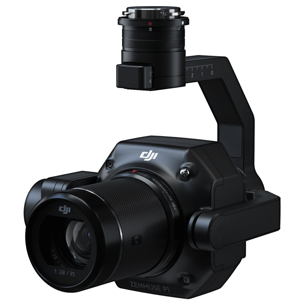
DJI P1![]()
The DJI Zenmuse P1 is a full-frame aerial photogrammetry camera designed for drone surveying. It features a 45 MP full-frame sensor, global mechanical shutter, and interchangeable 24/35/50 mm lenses for detailed imagery, capturing up to 3 km² in a single flight with centimeter-level accuracy. It’s great because it blends high-resolution mapping with efficient data collection, making large-area 2D and 3D surveys fast and accurate for infrastructure, construction, and GIS workflows
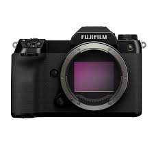
Fujifilm GFX 100S![]()
The Fujifilm GFX 100S is a mirrorless medium-format camera boasting a 102 MP sensor that delivers stunning image detail, wide dynamic range, and deep color depth.
Riebo R10 ProS![]()
The Riebo R10 ProS is a high-resolution metric aerial camera built specifically for photogrammetric mapping. With a massive sensor and global shutter, it captures ultra-sharp, distortion-free images. It’s great because it delivers exceptional image quality while remaining lightweight, allowing efficient flights and highly accurate orthophotos and 3D models.
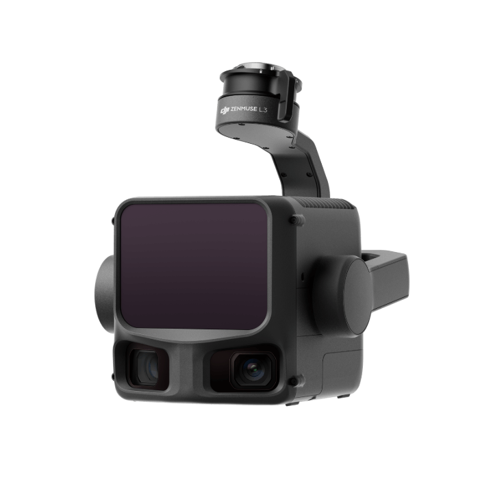
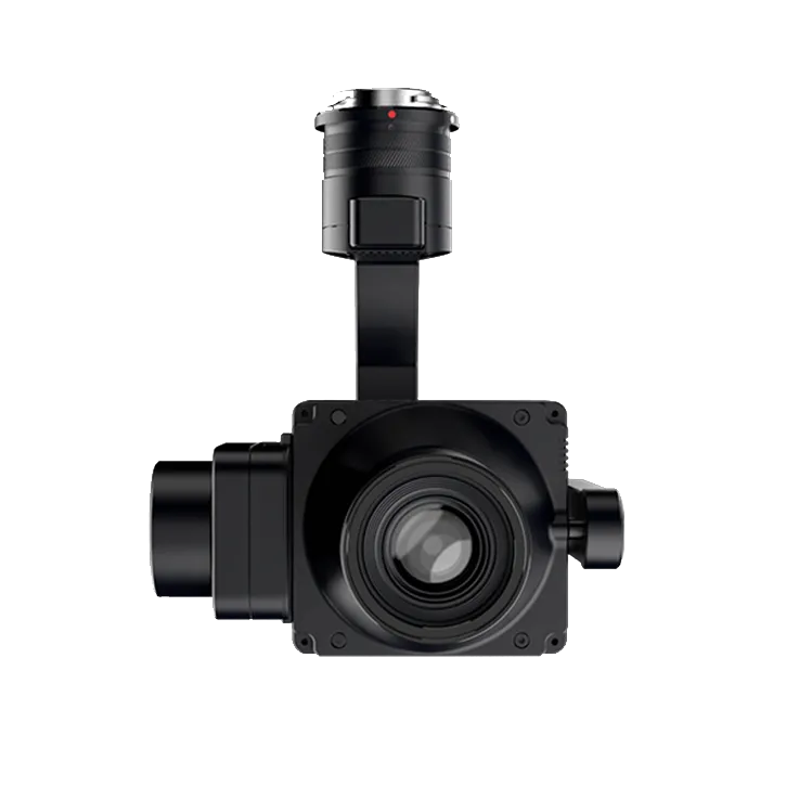
DJI Zenmuse L2![]()
The DJI Zenmuse L2 is an integrated LiDAR and RGB mapping payload designed for DJI enterprise drones. It combines laser scanning with a mechanical-shutter camera for accurate data capture. It’s great because it offers a streamlined, reliable workflow with strong accuracy, fast deployment, and excellent results in vegetated areas, making LiDAR mapping more accessible and efficient.
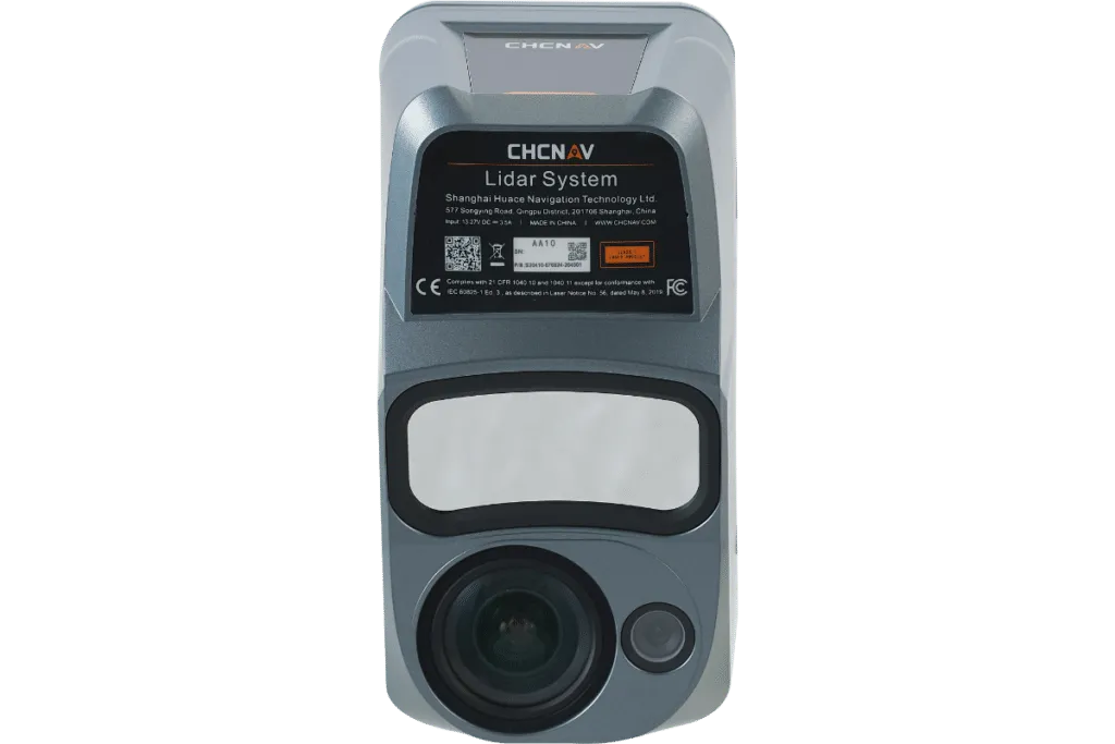
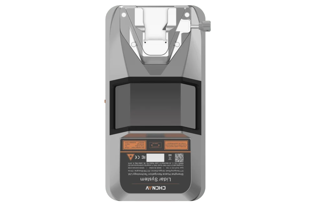
CHCNAV AlphaAir 9![]()
The AlphaAir 9 is a compact UAV LiDAR and RGB camera system designed for efficient airborne mapping. It combines laser scanning with high-resolution imagery in a lightweight package. It’s great because it delivers reliable survey-grade results while being easy to deploy, making it a flexible solution for topographic surveys, forestry, construction monitoring, and utility mapping.
CHCNAV AlphaAir 15 Pro![]()
The AlphaAir 15 Pro is a high-end airborne LiDAR system built for large-scale and high-density mapping. It supports long-range scanning and deep vegetation penetration. It’s great because it produces exceptionally detailed terrain models and corridor data, making it ideal for infrastructure projects, forestry analysis, and wide-area topographic surveys where data completeness is critical.
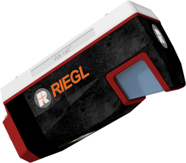
RIEGL VUX-160![]()
The RIEGL VUX-160 is a high-performance UAV LiDAR sensor designed for aerial mapping and corridor surveys. It captures extremely dense point clouds with excellent vegetation penetration. It’s great because its multi-angle scanning and high pulse rate produce detailed, gap free data, making it ideal for powerlines, roads, railways, and high-accuracy terrain modelling from the air.
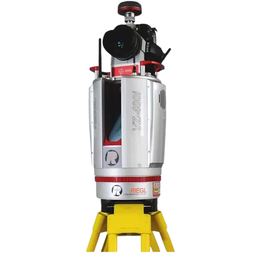
RIEGL VZ-400![]()
The RIEGL VZ-400 is a high-precision terrestrial laser scanner used for detailed 3D surveying from the ground. It captures dense, millimeter-accurate point clouds of terrain, structures, and infrastructure. It’s great because of its proven accuracy, reliability, and ability to capture complex environments, making it a trusted tool for engineering surveys, mining, and detailed as-built documentation.
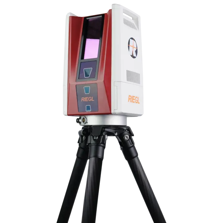
RIEGL VZ-600i![]()
The RIEGL VZ-600i is a next-generation terrestrial laser scanner built for speed and automation. It captures millions of points per second with extreme accuracy and supports real-time scan registration in the field. It’s great because it massively increases productivity, reduces processing time, and delivers ultra-clean data for large-scale topographic surveys, BIM modeling, and complex industrial environments.
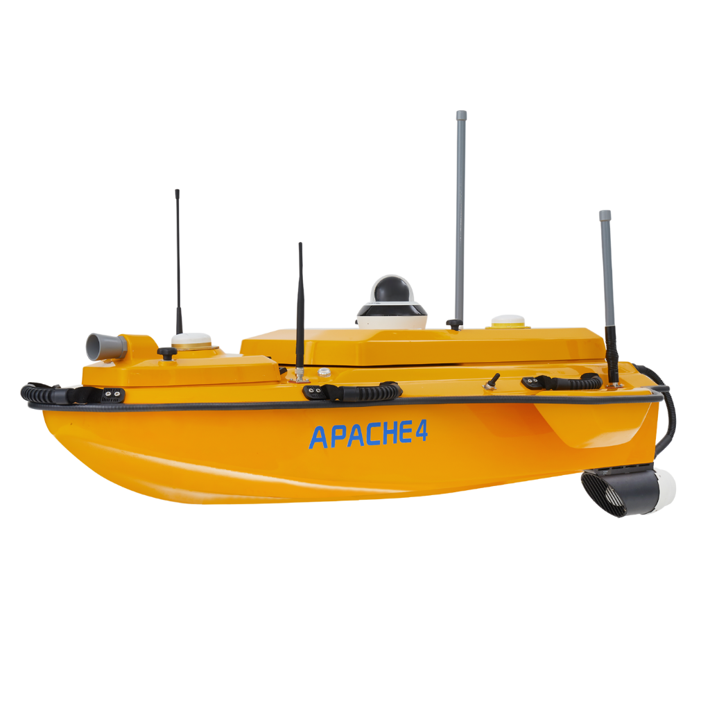
CHCNAV Apache 4![]()
The CHCNAV Apache 4 is an unmanned surface vehicle designed for hydrographic and river surveys. It carries echo sounders and flow sensors to map water depth and velocity safely. It’s great because it eliminates the need for manned boats, improves safety, and delivers precise bathymetric and hydrological data even in challenging water conditions.
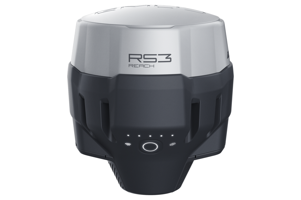
Emlid Reach RS3![]()
The Emlid Reach RS3 is an advanced RTK GNSS receiver with built-in tilt compensation. It allows accurate measurements even when the survey pole is not perfectly vertical. It’s great because it dramatically speeds up fieldwork, especially in tight or obstructed areas, while maintaining high accuracy and the simplicity Emlid receivers are known for.
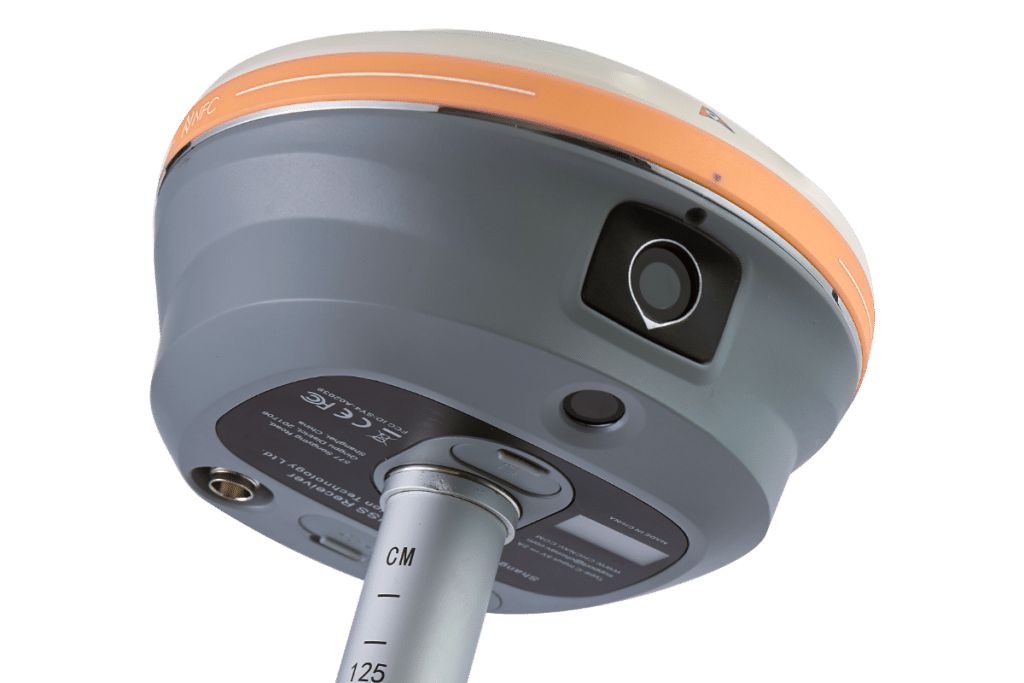
CHCNAV i93![]()
The CHCNAV i93 is a next-generation GNSS rover that combines RTK, IMU tilt compensation, and visual positioning using onboard cameras. It enables measurement of points that are difficult or unsafe to reach physically. It’s great because it increases productivity and safety while unlocking new surveying capabilities in complex urban and construction environment
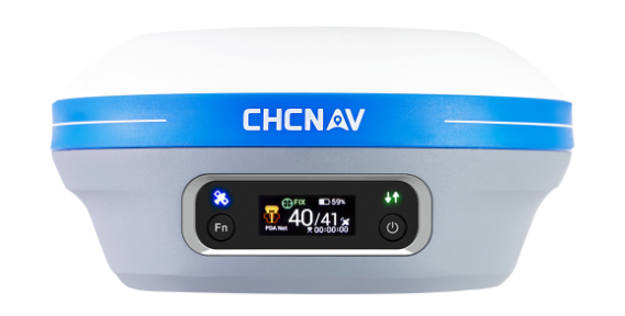
CHCNAV iBase![]()
The CHCNAV iBase is an all-in-one GNSS base station with an integrated high-power radio and battery. It provides reliable RTK corrections without external equipment. It’s great because it’s fast to deploy, extremely robust, and perfect for remote or temporary survey sites where dependable local RTK coverage is essential.
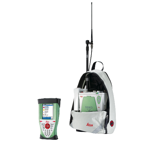
Leica System GS10 GPS ![]()
The Leica GS10 GPS receiver is a high-precision and reliable solution for land surveying. With its advanced technology and superior signal tracking capabilities, it provides accurate positioning and data collection for various surveying applications, ensuring efficient and precise measurements in the field.
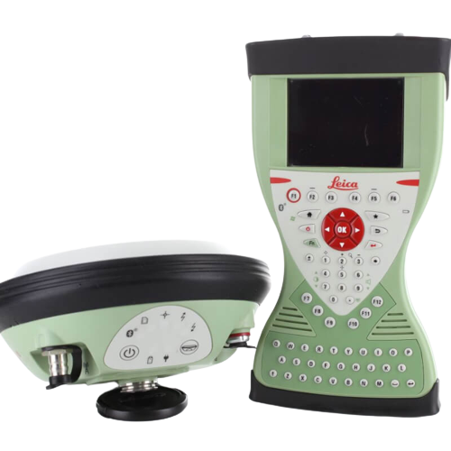
Leica System GS14 G.P.S![]()
The Leica System GS14 GPS is a rugged and versatile GNSS receiver designed for demanding surveying tasks. With its exceptional performance in challenging environments, multi-constellation support, and easy-to-use interface, it delivers reliable and accurate positioning data for efficient land surveying operations.
Leica System 900 G.P.S![]()
The Leica System 900 GPS is a highly advanced and versatile global positioning system designed for precise surveying applications. With its cutting-edge technology, comprehensive data management capabilities, and seamless integration with other surveying equipment, it ensures efficient and accurate data collection in various challenging environments.
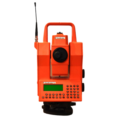
Geodimeter 610![]()
The Geodimeter 610 is a trusted and durable electronic distance meter used in land surveying. With its precise distance measuring capabilities, ease of use, and robust construction, it enables accurate measurements for a variety of surveying applications, including construction, mapping, and boundary determination.
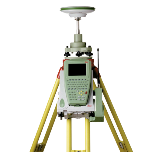
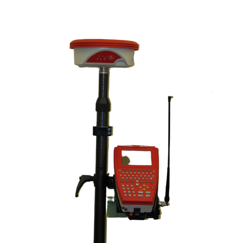
Leica System 1200 G.P.S![]()
The Leica System 1200 GPS is a professional-grade global positioning system renowned for its reliability and accuracy. With its advanced features like SmartTrack+ and SmartCheck, it offers superior signal tracking and real-time data quality control, making it an ideal choice for high-precision surveying and geodetic applications.
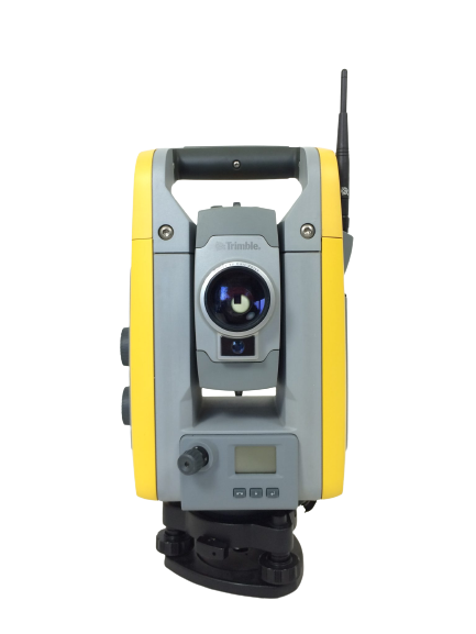
Trimble S6![]()
The Trimble S6 is a high-precision robotic total station known for its accuracy, speed, and advanced tracking technology. With its exceptional measurement performance, integrated imaging capabilities, and user-friendly interface, it enhances productivity and accuracy in land surveying projects, including construction layout, topographic surveys, and control point measurements.
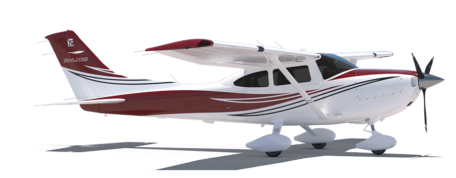
Cessna 182![]()
Our Cessna 182 is a fully modified manned survey aircraft engineered to carry advanced LiDAR and photogrammetry systems. It provides long endurance, stable flight characteristics, and the ability to operate at higher altitudes and over vast areas. It’s great because it enables large scale, high density data collection in a single mission, making it ideal for regional mapping, corridor surveys, and projects where UAVs are limited by range, airspace, or payload capacity.