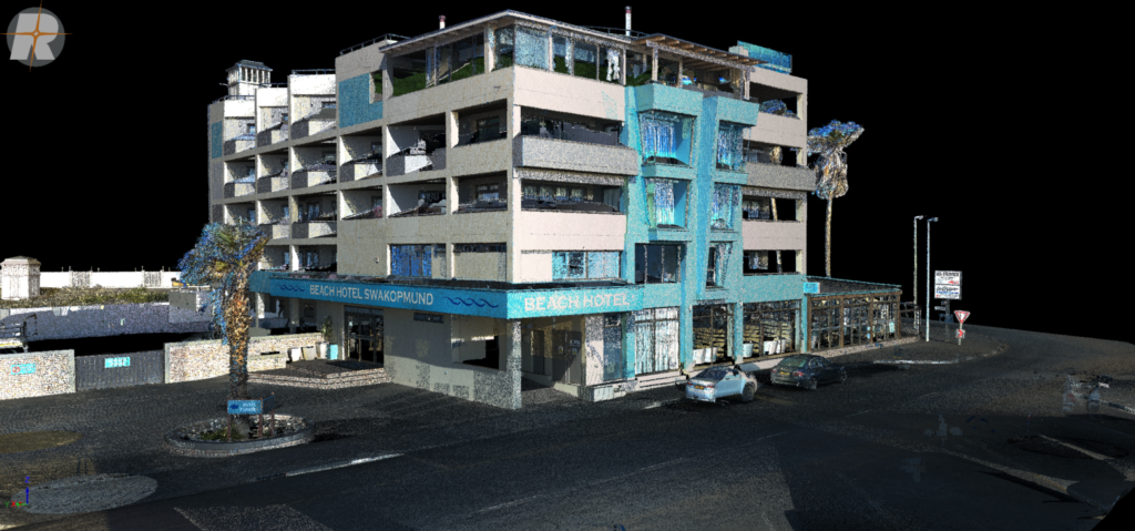
Our terrestrial laser scanning surveys deliver millimetre accurate, high density point cloud data capturing structures, terrain, and complex environments in exceptional detail. TLS is ideal for as built verification, structural analysis, industrial facilities, and heritage documentation where precise geometry and full spatial context are critical.
As Built Surveys
Unlike traditional survey methods, Terrestrial Laser Scanning captures millions of measurements from a single setup, creating a complete and highly detailed record of structures exactly as they exist. This allows for accurate verification of construction works and reliable documentation for project handover and compliance.
Typical applications
• Construction as built verification
• Handover documentation and record drawings
• Dimensional compliance checks
• Dispute resolution and progress validation
Structural & Façade Scanning
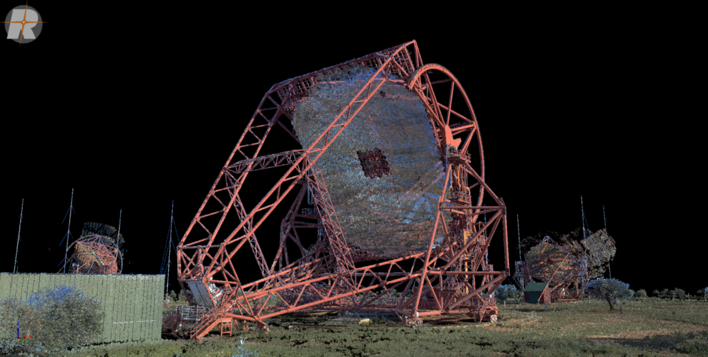
Terrestrial Laser Scanning provides millimetre accurate geometry of buildings and structural elements, allowing complex façades, bridges, and retaining structures to be measured without physical contact. The resulting data supports deformation assessment, condition analysis, and precise engineering evaluation.
Typical applications
• Structural assessment and deformation analysis
• Façade mapping and elevation extraction
• Bridge and retaining wall surveys
• Condition monitoring of critical structures
Structural & Façade Scanning
Terrestrial Laser Scanning provides millimetre accurate geometry of buildings and structural elements, allowing complex façades, bridges, and retaining structures to be measured without physical contact. The resulting data supports deformation assessment, condition analysis, and precise engineering evaluation.
Typical applications
• Structural assessment and deformation analysis
• Façade mapping and elevation extraction
• Bridge and retaining wall surveys
• Condition monitoring of critical structures
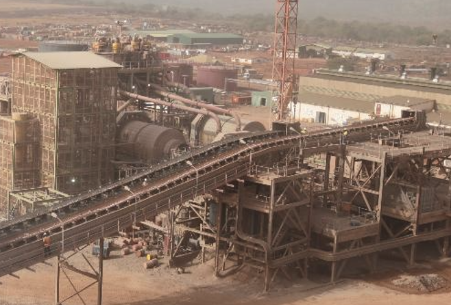
Industrial & Plant Scanning
TLS enables the rapid capture of complex industrial environments, producing dense point clouds that accurately represent pipework, equipment, and structural layouts. This data supports safe planning of upgrades, retrofits, and expansions without disrupting ongoing operations.
Typical applications
• Industrial plant and facility documentation
• Pipework and equipment modelling
• Retrofit and upgrade planning
• Clash detection and clearance analysis
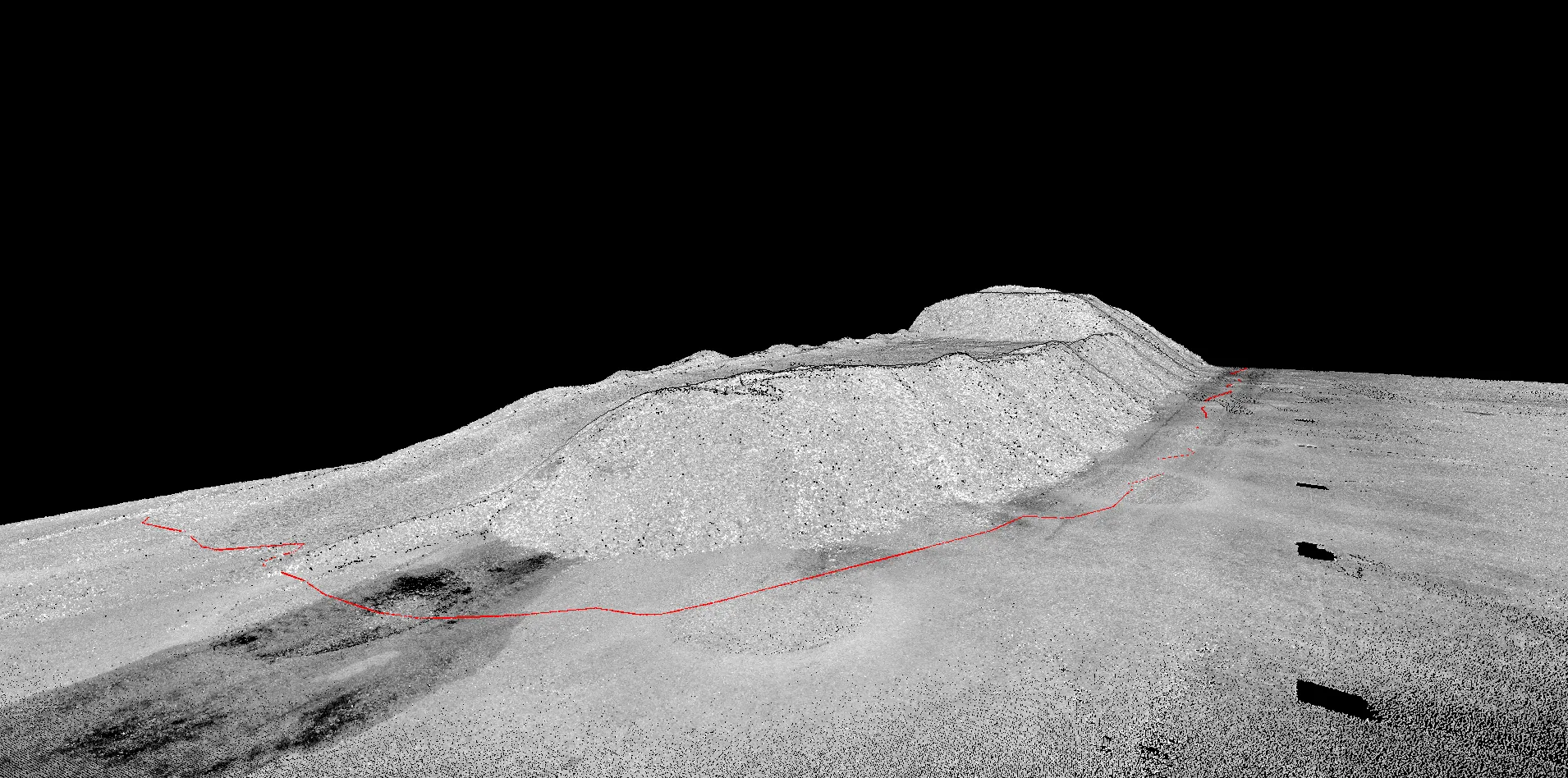
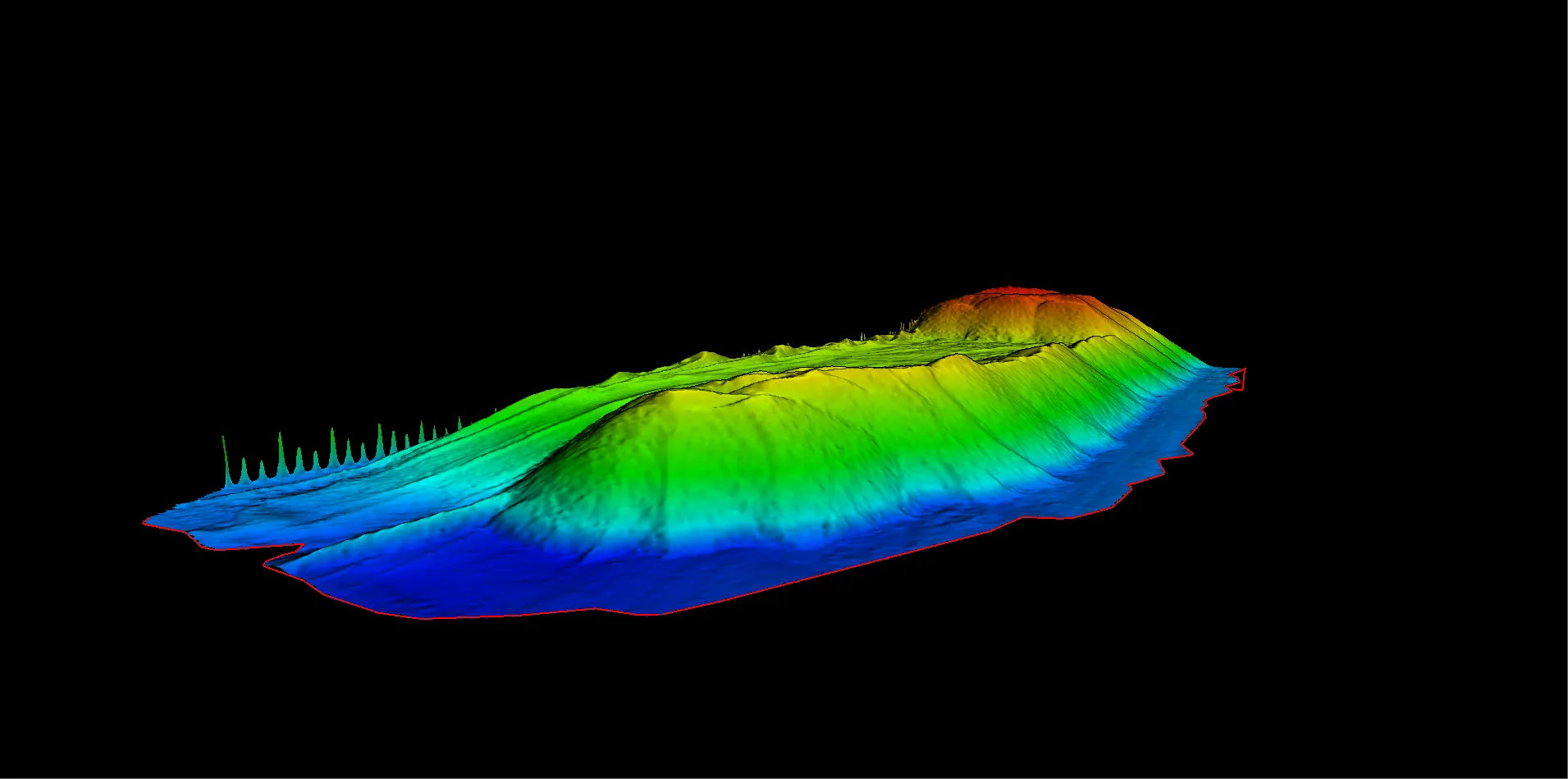
Volume & Stockpile Analysis
High resolution terrestrial scans allow material volumes to be calculated quickly and safely, even in confined or hazardous environments. TLS removes the need for personnel to access unstable stockpiles while delivering reliable and repeatable volume measurements.
Typical applications
• Stockpile and quarry volume calculations
• Mine and material yard assessments
• Progress tracking of earthworks
• Independent verification of reported quantities
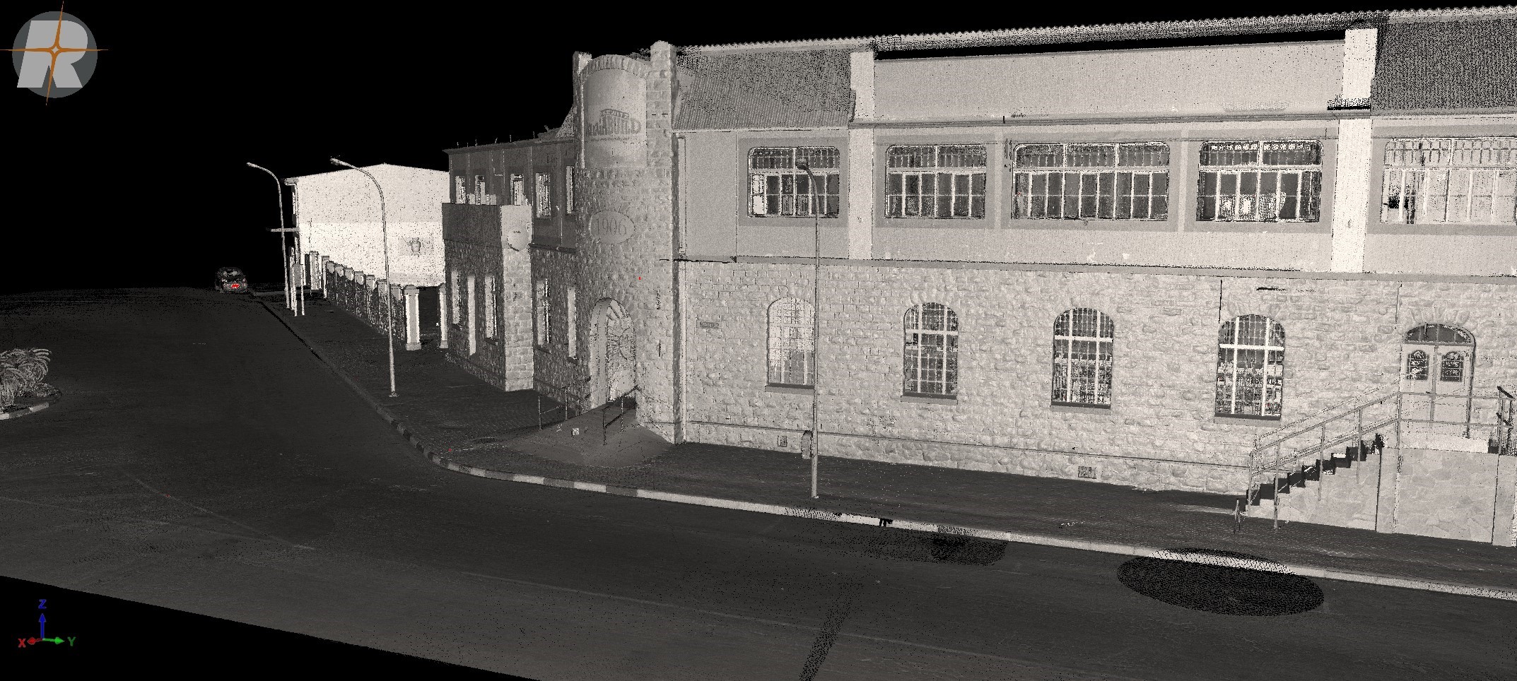
Heritage & Conservation Documentation
Terrestrial Laser Scanning offers a non invasive method for documenting heritage structures in exceptional detail. The resulting datasets provide a permanent digital record that can be used for conservation planning, restoration design, and long term archival purposes.
Typical applications
• Heritage building documentation
• Conservation and restoration planning
• Historical record creation
• Structural condition assessment of sensitive sites
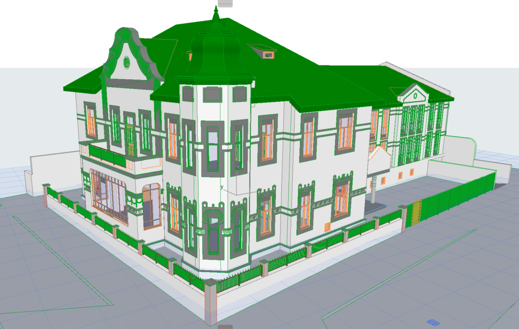
BIM & CAD Model Generation
TLS point clouds can be converted into accurate CAD and BIM models, providing a reliable foundation for design and coordination. This ensures that engineering and architectural work is based on the true geometry of existing conditions.
Typical applications
• Scan to BIM workflows
• CAD model generation for design
• Engineering coordination and clash detection
• Retrofit and refurbishment projects
Marine Vessel Scanning & Documentation
Laser scanning of marine vessels provides precise three dimensional capture of entire hulls, superstructures, and onboard systems. Most vessels lack complete as-built documentation, which can complicate maintenance, certification, retrofits, and equipment upgrades. Our marine vessel scanning service delivers accurate point cloud data and 3D models that reflect the true geometry of the vessel, enabling engineers, naval architects, and shipyards to plan and execute work efficiently and with confidence.
Typical applications
• Full hull and superstructure laser scans for accurate geometry capture
• 3D modelling for design, refit and equipment alignment
• Clash detection and deviation analysis against proposed designs
• Documentation of engines, ballast and scrubber systems for upgrades
• Virtual walkthroughs to support safety briefings and contractor planning