Our airborne LiDAR surveys deliver high density, high accuracy point cloud data capable of penetrating vegetation and revealing true ground surfaces. This makes LiDAR ideal for terrain modelling, corridor mapping, and infrastructure planning across complex landscapes.
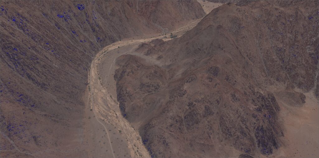
In steep, rugged, or highly variable terrain, LiDAR provides consistent coverage and accuracy where line of sight, access, and safety become challenging. Our flight planning and processing workflows are specifically designed to handle extreme elevation changes, sharp slopes, and irregular surfaces.
Typical applications
• Corridor mapping through mountainous terrain • Road and rail design in hilly areas • Drainage and flood modelling • Terrain analysis for engineering and planning
Confidence closer
Unlike passive imaging systems, LiDAR can penetrate vegetation by capturing multiple returns from a single laser pulse. This allows us to separate vegetation from the underlying terrain and produce accurate ground models in areas with dense or complex vegetation cover.
Typical applications
• True ground surface extraction under vegetation • Environmental and ecological studies • Powerline and corridor vegetation analysis • Floodplain and river modelling
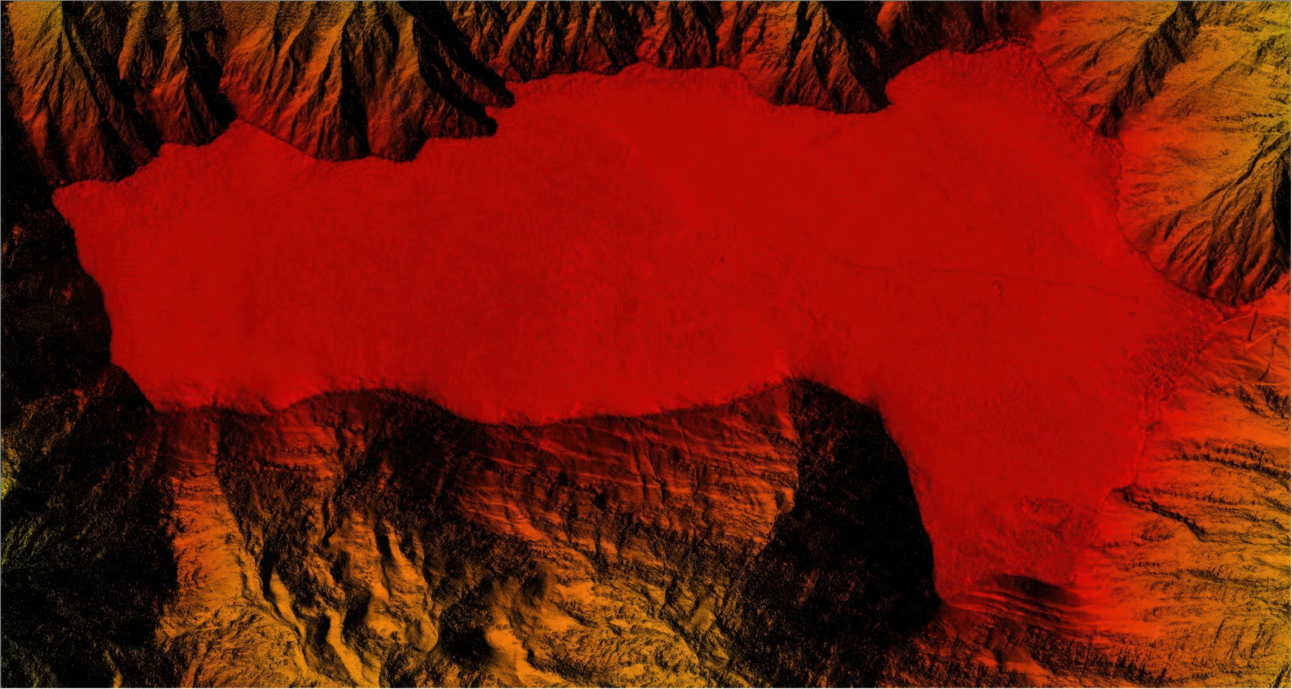
Our LiDAR surveys produce highly accurate terrain and elevation products that form the foundation for engineering, planning, and environmental analysis. These include Digital Terrain Models and Digital Elevation Models that accurately represent ground surfaces, as well as Digital Surface Models capturing buildings, vegetation, and other above ground features. From these datasets we generate bare earth surfaces, hillshades, slope and aspect maps, allowing terrain to be clearly visualised and analysed even in complex or inaccessible areas.
LiDAR data enables the creation of detailed 3D models that accurately represent terrain, corridors, and built features in three dimensions. These models provide a clear spatial understanding of landscapes and infrastructure, making them ideal for design validation, planning, and stakeholder communication. From site scale models to large corridor visualisations, 3D outputs allow complex information to be explored, measured, and understood from any angle.
LiDAR data enables the creation of detailed 3D models that accurately represent terrain, corridors, and built features in three dimensions. These models provide a clear spatial understanding of landscapes and infrastructure, making them ideal for design validation, planning, and stakeholder communication. From site scale models to large corridor visualisations, 3D outputs allow complex information to be explored, measured, and understood from any angle.
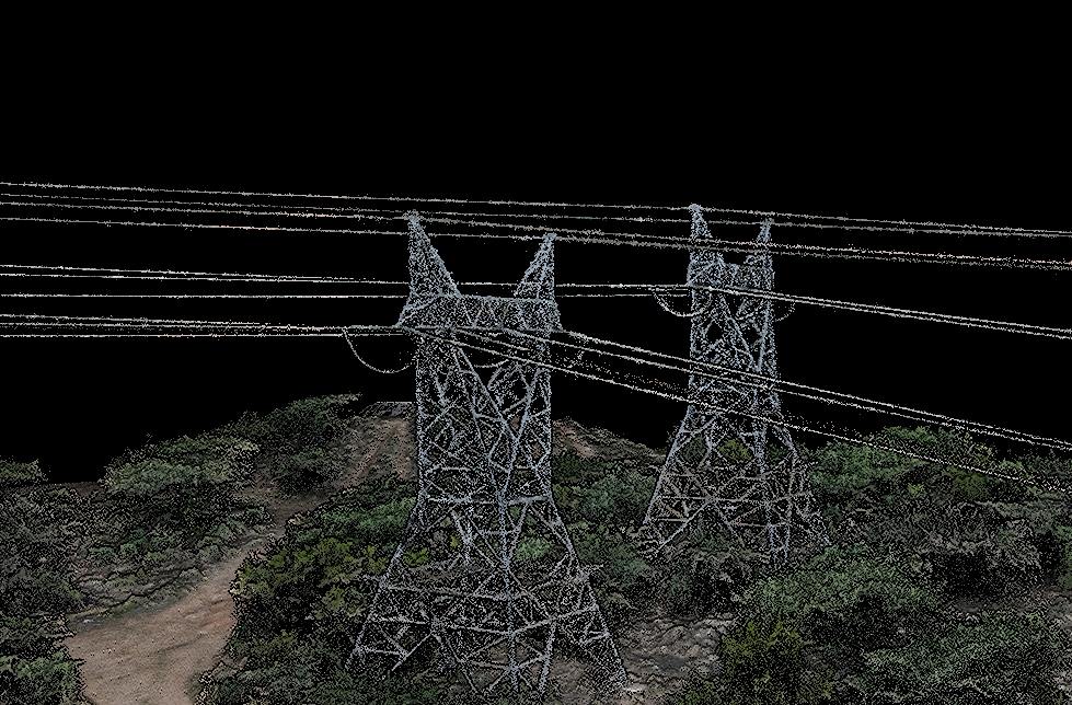
LiDAR is an ideal tool for powerline surveys, delivering precise information on conductor positions, tower structures, and surrounding vegetation. By accurately modelling the relationship between powerlines, terrain, and vegetation, LiDAR enables reliable clearance assessments, vegetation encroachment analysis, and ongoing asset management. This approach improves safety, supports compliance requirements, and provides a clear digital record of transmission infrastructure.
Our Fleet
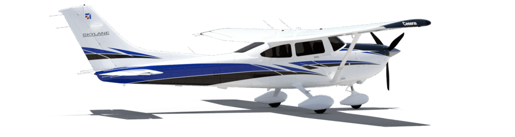
Cessna 182 Survey Platform
A fixed wing survey aircraft purpose built for airborne mapping missions. Equipped with an external wing strut mounted sensor pod, providing stable, vibration isolated data capture over large areas with long endurance and consistent flight profiles.
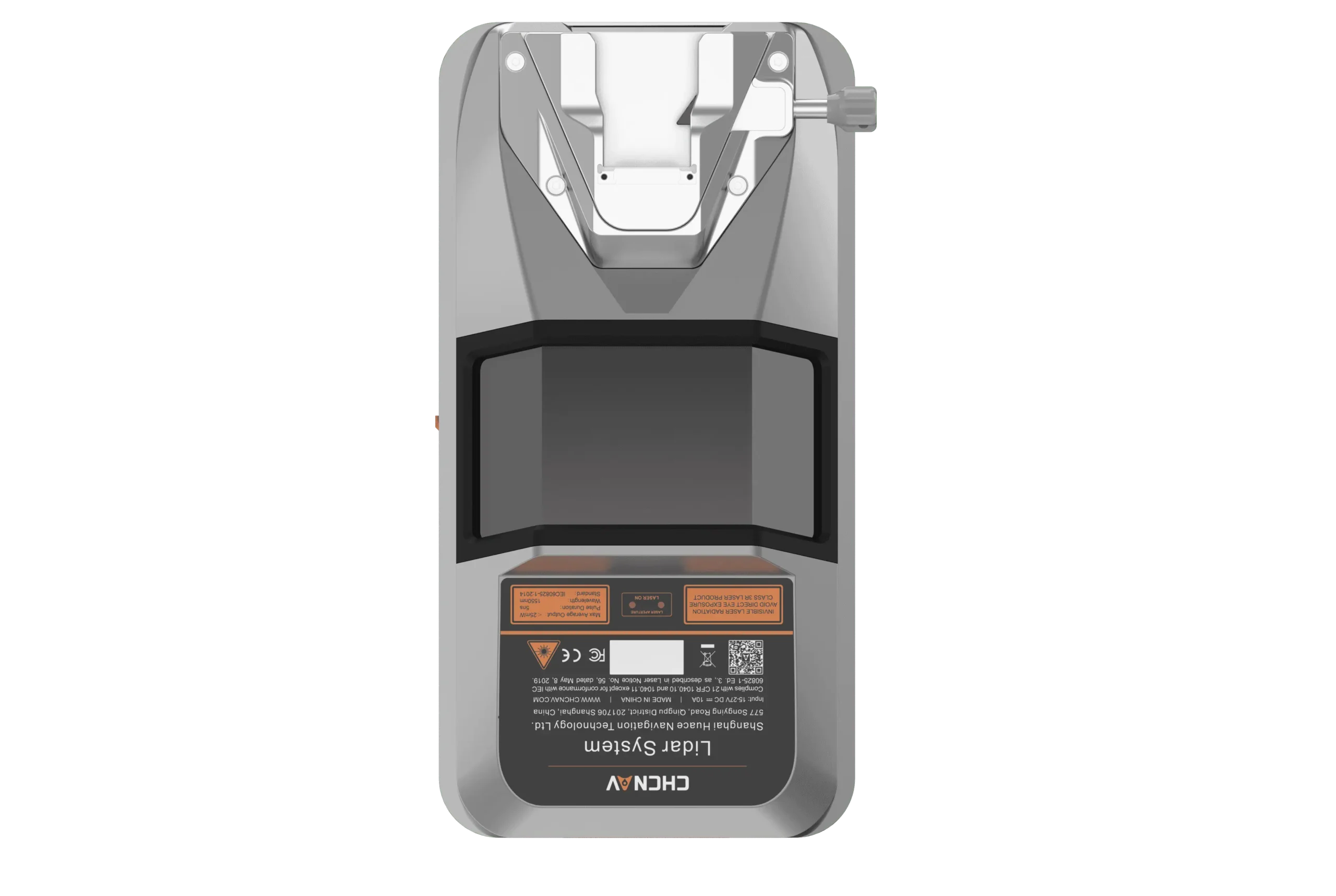
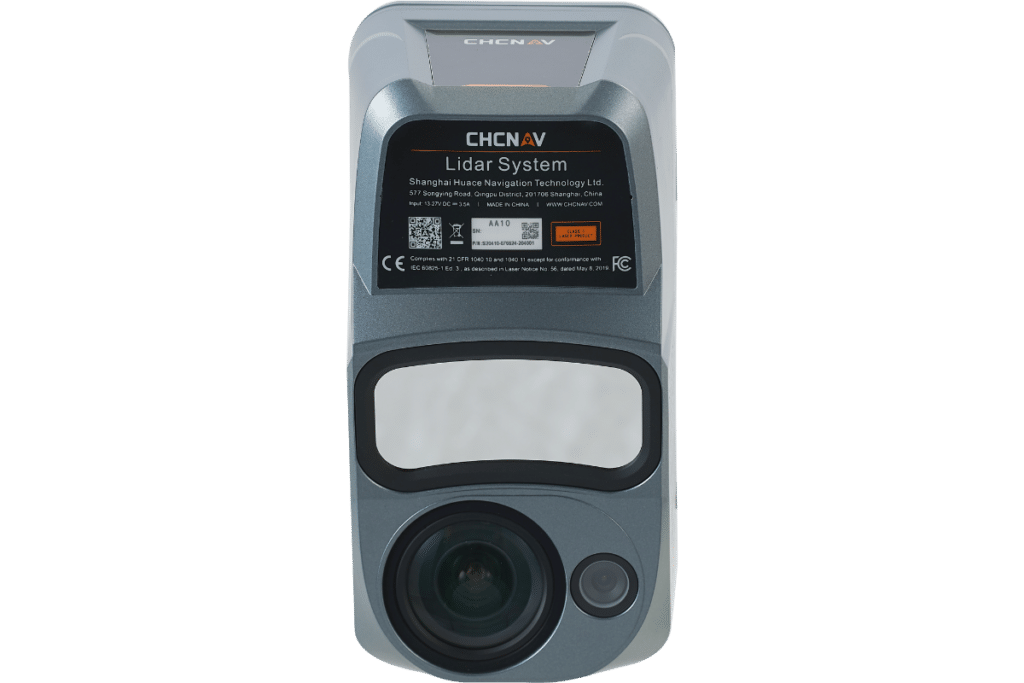
CHCNAV AlphaAir 15 Pro LiDAR
Next generation airborne LiDAR system delivering exceptional accuracy, stability, and efficiency. The AlphaAir 15 Pro integrates advanced inertial navigation with high resolution laser scanning to produce consistent, high quality point clouds across varied terrain and operating conditions.
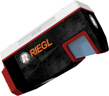
RIEGL VUX-160 Airborne LiDAR
The RIEGL VUX-160 employs a unique multi angle scanning pattern, consecutively emitting laser pulses in three directions. The beam alternates between true nadir, 10 degrees forward, and 10 degrees backward, enabling exceptionally complete data capture.
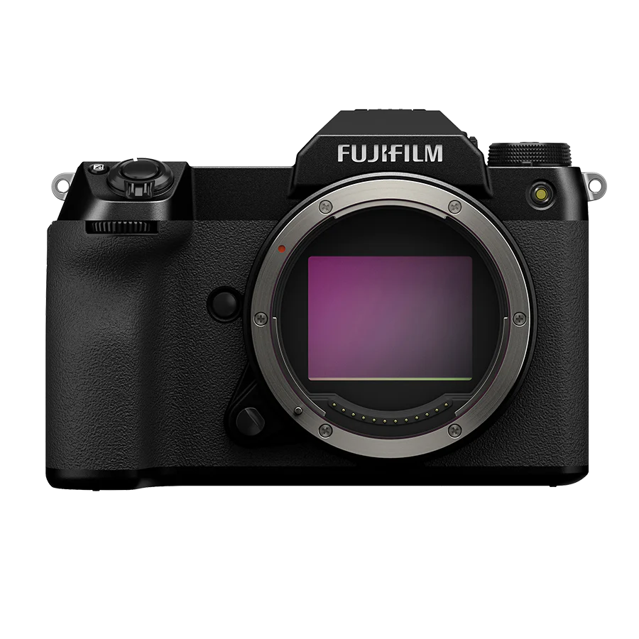
Fujifilm GFX 100S
A high resolution medium format camera producing exceptional image clarity and colour depth. Ideal for photogrammetry, orthophoto generation, and detailed visual mapping where precision and image quality are critical.
Riebo R10 ProS
A compact LiDAR sensor designed for UAV operations requiring efficiency and precision. Provides reliable point cloud data for mapping, inspection, and surface analysis where flexibility and rapid deployment are essential.
CHCNAV AlphaAir 9
A lightweight airborne LiDAR solution optimized for UAV platforms. Delivers accurate elevation data with high point density, well suited for terrain modelling, corridor surveys, and environmental mapping.
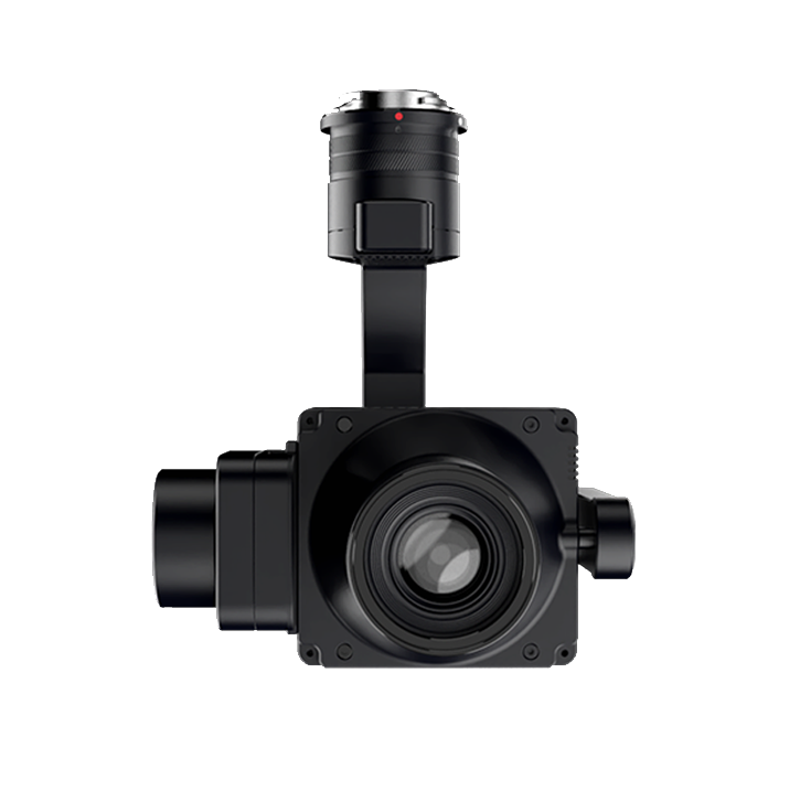
DJI Zenmuse L2
An integrated LiDAR and RGB payload designed for UAV mapping. Combines laser scanning with calibrated imagery, making it ideal for topographic surveys, stockpile measurements, and rapid data collection over small to medium areas.
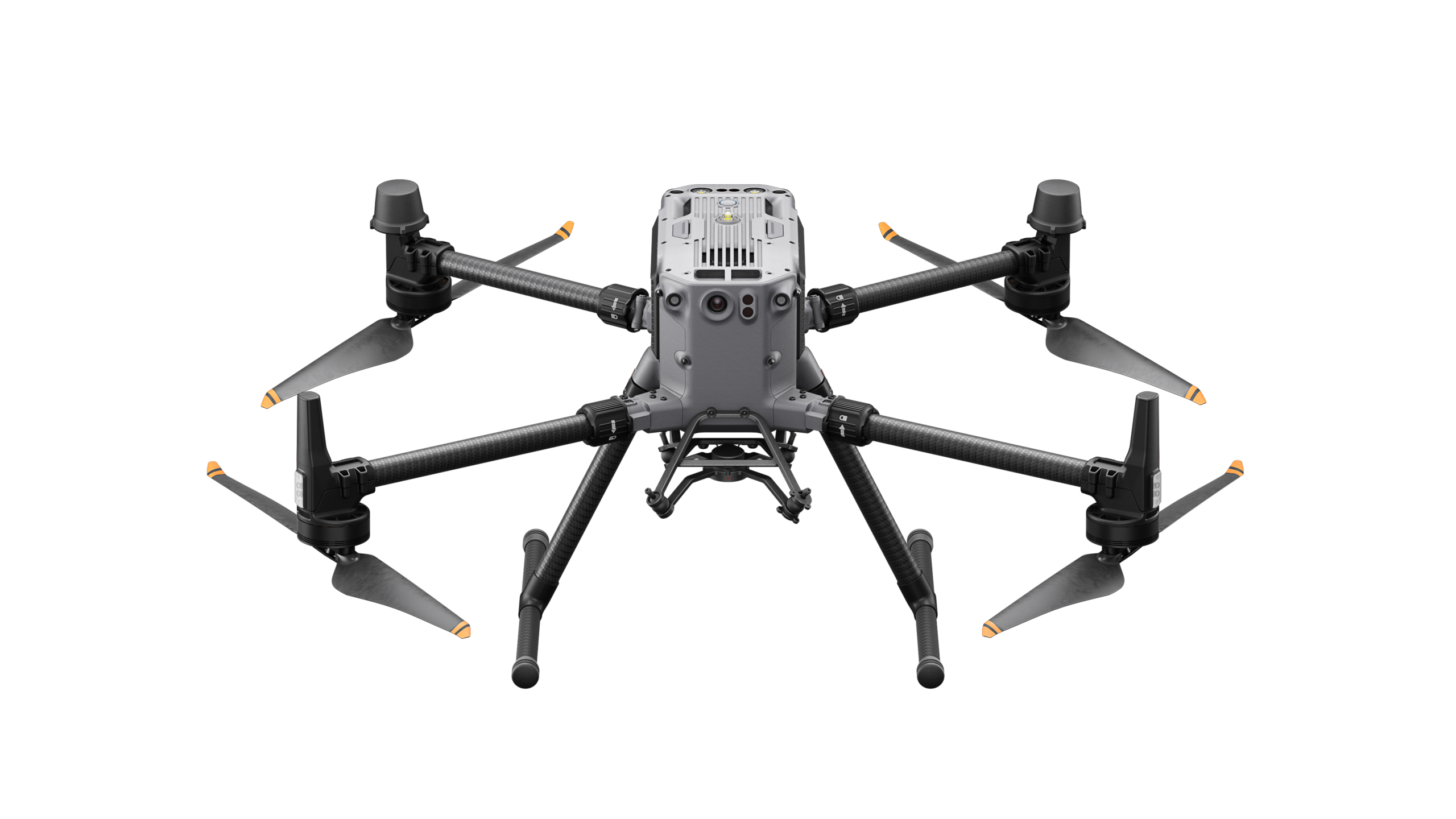
DJI Matrice 300
A robust enterprise UAV platform supporting multiple payload configurations. Provides high endurance, precise positioning, and reliability for LiDAR scanning, photogrammetry, inspections, and complex survey operations.
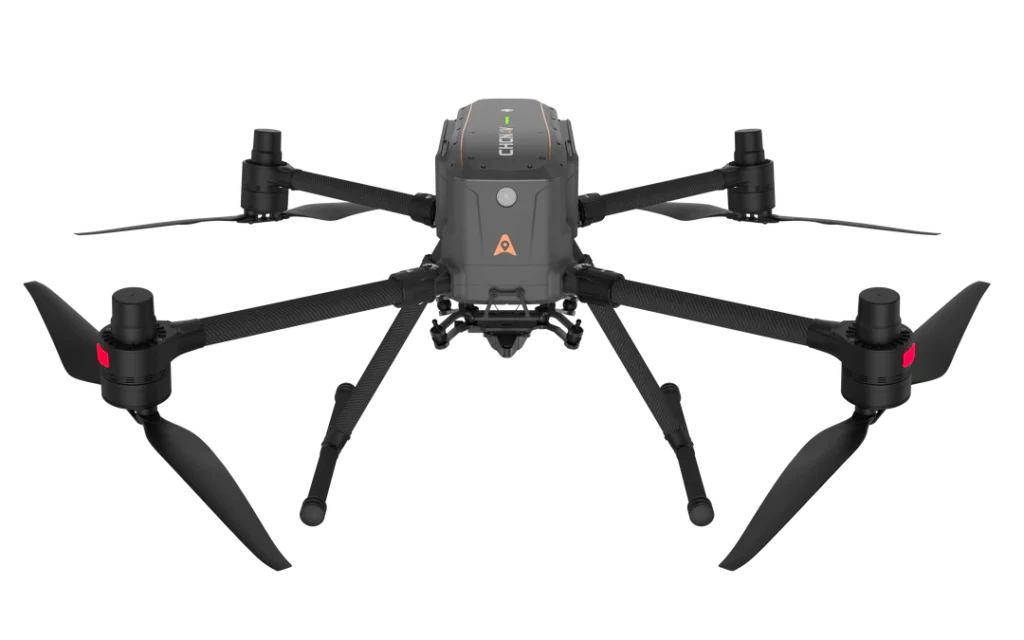
CHCNAV X500 UAV
An industrial grade multirotor platform designed to carry advanced LiDAR and camera payloads. Offers stability, redundancy, and precision positioning for professional survey and mapping missions.
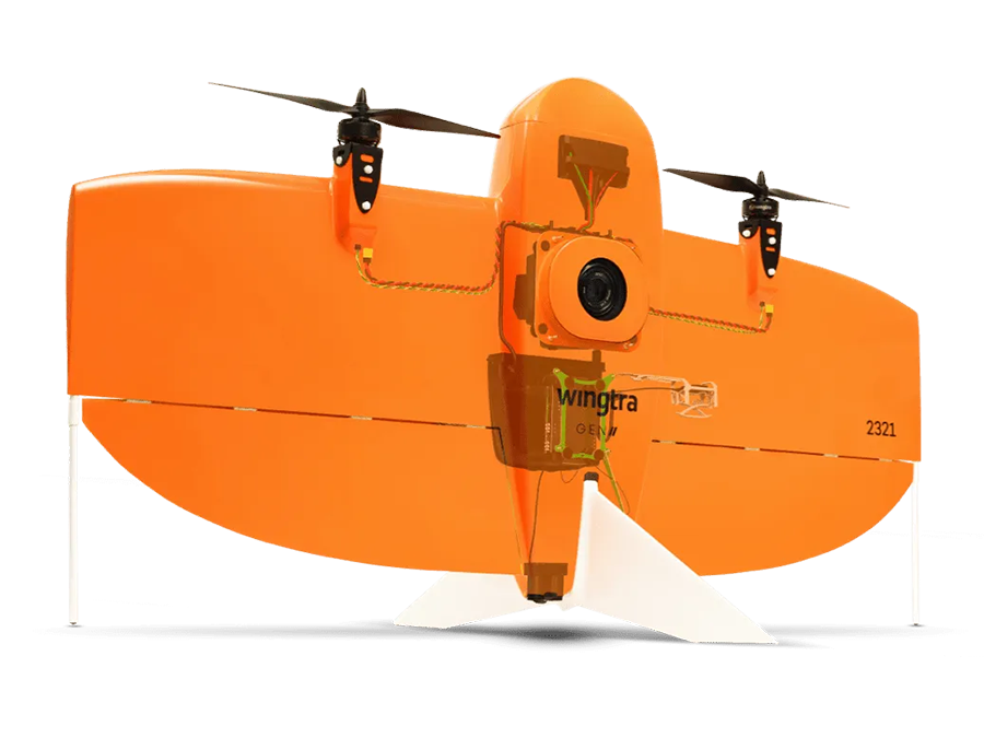
Wingtra Gen II
A VTOL fixed wing drone combining vertical takeoff with long range fixed wing efficiency. Enables rapid deployment and high resolution mapping over large areas without the need for runways or launch systems.
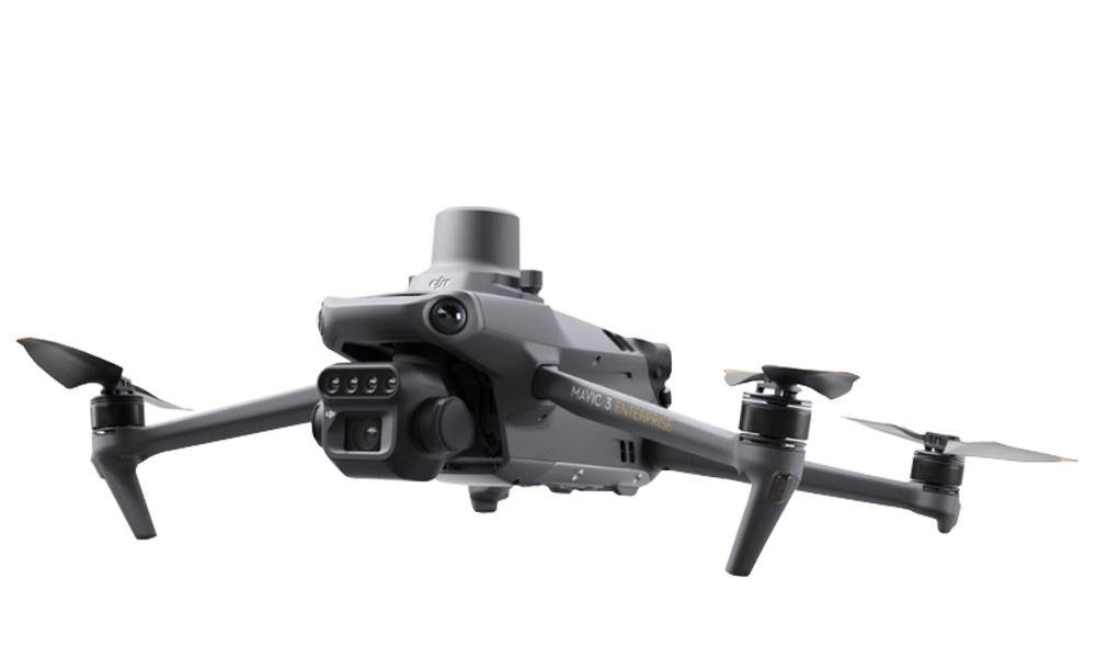
DJI Mavic 3 Multispectral
A multispectral UAV platform capturing both RGB and spectral data. Used for vegetation analysis, crop health monitoring, environmental assessment, and land use evaluation across agricultural and natural landscapes.
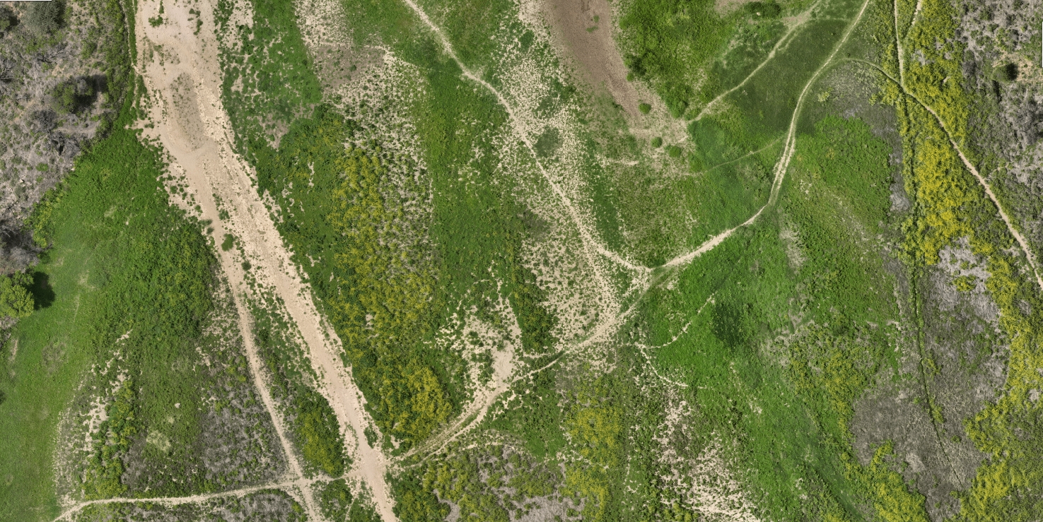
High Resolution Aerial Imagery
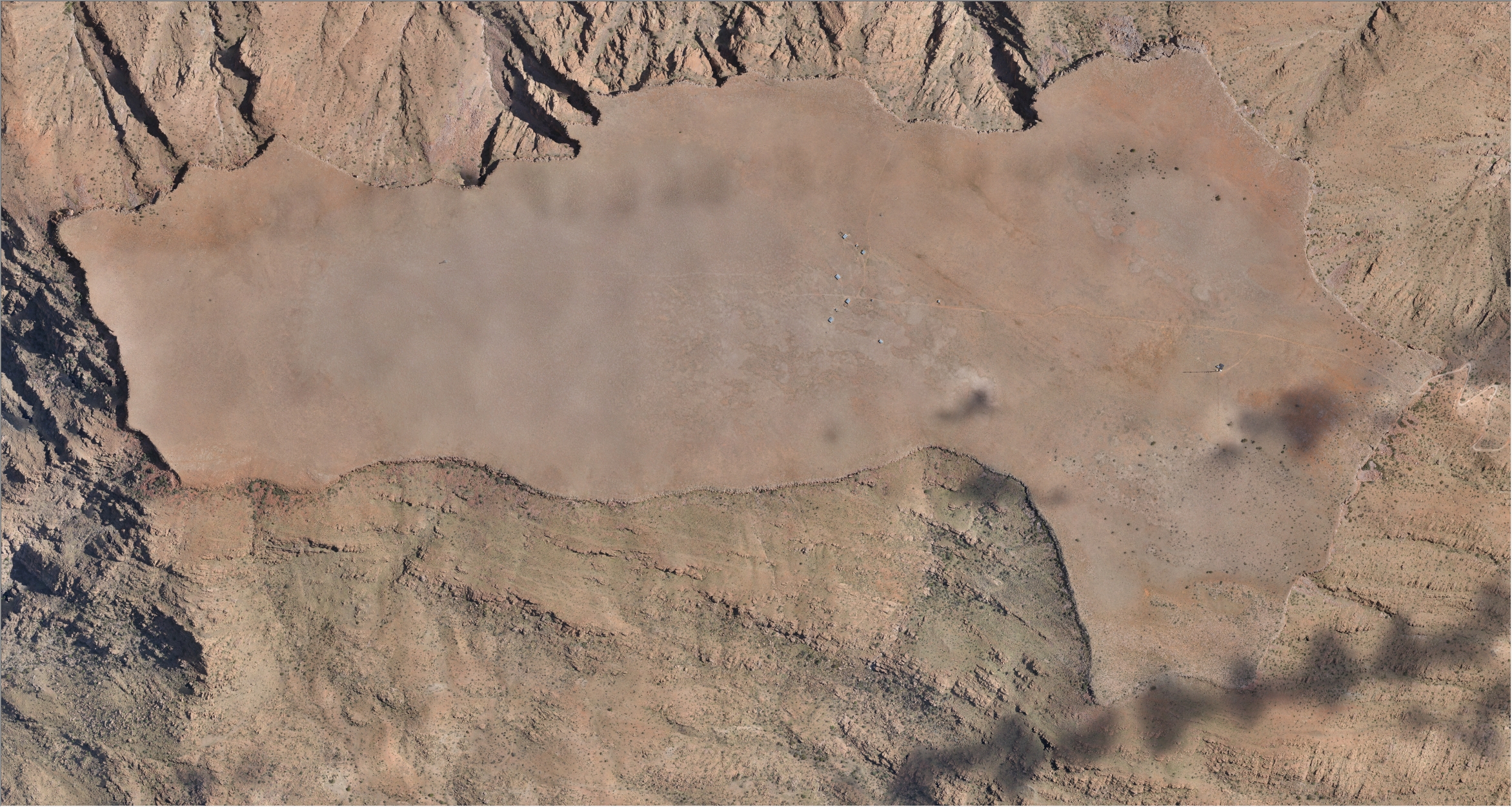
High resolution aerial imagery provides detailed and up to date visual records of large areas captured from above. Using calibrated cameras and controlled flight planning, we produce sharp, georeferenced imagery that accurately represents surface features, infrastructure, and land use conditions. These datasets form a reliable visual foundation for mapping, analysis, and decision making across a wide range of projects.
Typical applications • Orthophoto generation for mapping and planning • Visual site inspections and condition assessments • Environmental and land use monitoring • Engineering and infrastructure documentation • Project progress tracking and reporting
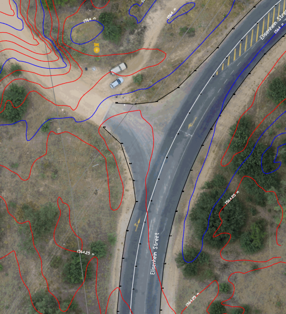
Mapped Features & Linework Extraction
Using high resolution, accurately georeferenced orthophotos, we digitally extract roads, kerbs, manholes, drainage structures, buildings, and other visible infrastructure with survey grade positional accuracy. This process delivers clean, reliable linework and feature data suitable for direct use in CAD and GIS environments, supporting design, planning, asset management, and infrastructure documentation workflows.
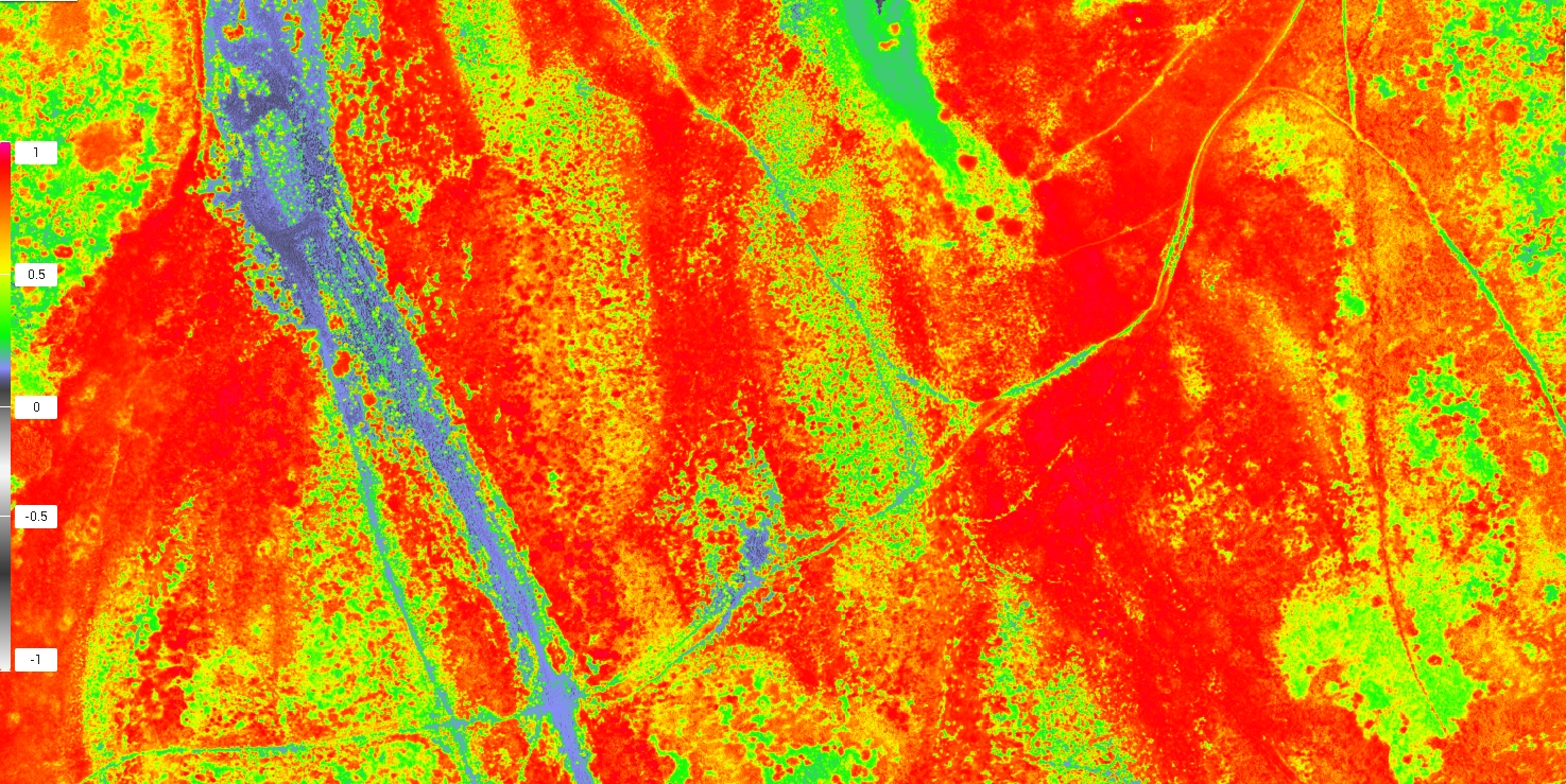
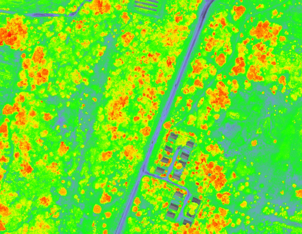
NDVI Crop Health Detection
NDVI analysis uses multispectral imagery to assess crop health, vigour, and uniformity by measuring reflected light from vegetation. This allows us to identify stressed or underperforming areas that are not visible in standard aerial imagery.
Early detection supports informed decision making and targeted interventions, improving crop management and yield potential.
Agriculture & Stress Detection
Multispectral analysis assists in identifying plant stress related to water availability, nutrient deficiencies, disease, and soil variability. By mapping these variations, land managers can implement targeted interventions rather than blanket treatments.
This approach improves efficiency, reduces input costs, and supports sustainable agricultural practices.
Rehabilitation & Environmental Monitoring
Multispectral surveys provide a reliable method for monitoring vegetation recovery and environmental rehabilitation over time. Repeat surveys allow objective measurement of change, supporting compliance reporting, environmental assessments, and long-term land restoration projects.
This data driven approach ensures rehabilitation progress can be tracked, verified, and documented with confidence.