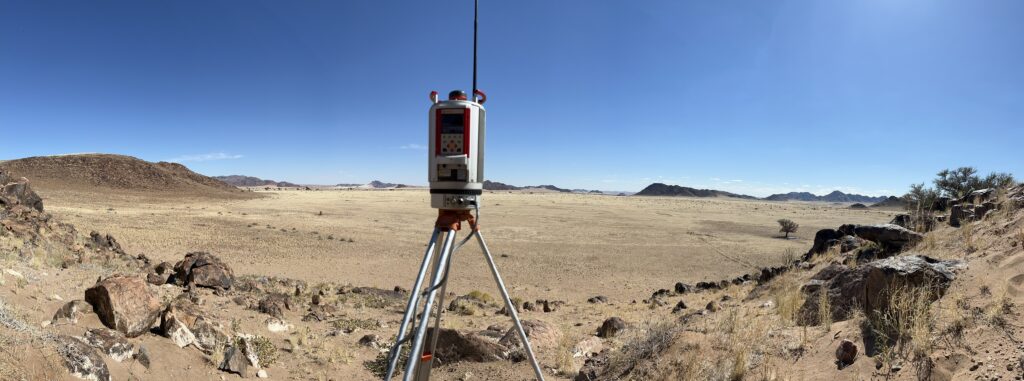
Terrestrial 3D Scanning
At Strydom and Associates, we have been utilizing terrestrial 3D scanning since 2020 . Our team recognized the immense potential of this technology and its applications across various sectors. Over the years, we have continuously upgraded our equipment and expertise to stay at the forefront of the industry.
Our terrestrial 3D scanning services encompass a wide range of applications, including:
1. Building Documentation: We can capture detailed 3D scans of existing structures, facilitating accurate measurements, as-built documentation, and preservation efforts.
2. Civil Infrastructure: Our scanning capabilities extend to large-scale infrastructure projects such as bridges, roads, tunnels, and dams. We can capture precise data for design, analysis, and maintenance purposes.
3. Cultural Heritage Preservation: Terrestrial 3D scanning allows us to digitally document and preserve historical sites, monuments, and artifacts with exceptional accuracy, aiding in conservation and restoration efforts.
4. Industrial Facilities: We can provide comprehensive scans of industrial plants, factories, and manufacturing facilities for layout planning, maintenance, and safety assessments.
5. Real Estate and Construction: Our scanning services can assist in the construction and real estate sectors by providing accurate measurements, creating detailed 3D models, and facilitating clash detection.
Our state-of-the-art equipment includes [list specific equipment], which enables us to capture high-resolution scans with precision and efficiency. Our experienced team of professionals ensures that the collected data is processed and delivered in formats suitable for various applications, such as point clouds, mesh models, or CAD drawings.
At Strydom and Associates, we are committed to delivering top-quality terrestrial 3D scanning services tailored to the unique needs of our clients. Our expertise, combined with advanced technology, ensures accurate and reliable results for projects of any scale.
If you require terrestrial 3D scanning services or have any further inquiries, please don’t hesitate to reach out. We look forward to assisting you in your surveying and documentation needs.
